Ávila: a town for everyone

Ávila is a Spanish fortified city located in the autonomous community of Castile and León, and is the capital of the Province of Ávila.

It is sometimes called the Town of Stones and Saints, and it claims that it is one of the towns with the highest number of Romanesque and Gothic churches per capita in Spain.

If you are in Madrid on holidays and you still have days ahead, this city is highly recommended to visit, as well as its neighboring city Segovia. For these two cities, it does not take more than a day to visit all its secrets.
It is advisable to leave early in the morning and return late at night.
To go to Ávila from Madrid, there are daily buses on this page. Another quick and also economical alternative is to use Blablacar. For less than € 8 you can go to Ávila in 1h30m.

What to see in Ávila? These are the most recommended places to visit in this little city

1. Visit the Cathedral of Ávila

Location: https://goo.gl/maps/h97VpmyUrEWcDshz5

Austere Romanesque-Gothic cathedral built into the city walls, with a striking stone interior.

2. Walk by Plaza de Santa Teresa de Jesus

wp-1579511635324.jpg

Location: https://goo.gl/maps/De2o2xCjLCdJNDQq9

Located in the heart of Avila, it’s just in front of Puerta del Alcazar

3. Walk over the walls of Avila at Puerta de la Adaja (Adaja’s Gate)

Location: https://goo.gl/maps/BWUaeuj4a6eixJb86

There are several entrances to the walls of Ávila so depending on where you are, you can entry to the walls from several points.

SCHEDULE

From October 27 to March from 10.00 to 18.00 31. Closed Monday,
From march 29 to June 30 from 10.00 to 20.00. monday open
From July 1 to August 31 from 10.00 to 21.00. monday open
From September 1 to October 27 from 10.00 to 20.00. monday open
Last access Gate of Álcazar: 30 m. before closing. The house of Las Carnicerías, the gate of El Carmen and the gate of El Puente 45m before closing

PRICES

General Price: €5.00
Reduced Price: €3.50
Free: Tuesdays from 14:00 to 16:00 except public holidays and eve of public holidays. BIC monument

More info here if you want to buy tickets online

4. Visit the Roman bridge of Ávila

wp-1579511635121.jpg

Location: https://goo.gl/maps/Tet7y12itY6iz5qx8

Beautiful bridge located near the walls at the South of the city next to Adaja’s Gate. This Roman bridge was built in the early-1st century A.D

5. Visit the highest Viewpoint of Ávila (4 postes)

DSC03878-Pano

Location: https://goo.gl/maps/UUo438Lgn62Qd7Jm9

Here you will find the best views of Avila and its walls. Perfect for sunset and end the day

Ávila still have few more places to visit so if you have more time ahead do not hesitate to drop by the following places!

6. Palacio de Polentinos

Location: https://goo.gl/maps/9cZv3mhBV9AFxgMF8

7. Plaza Mercado Chico

Location: https://goo.gl/maps/JubjzNFEzoYBFXgN9

8. Basílica de San Vicente

Location: https://goo.gl/maps/CAhJMUjth8tVfeGG9

Hokkaido: living Sakura

Hokkaido is the second largest island in Japan. The Tsugaru Strait separates it from the great island of Honshu although they remain united through the Seikan tunnel. The largest city of Hokkaido is Sapporo, its capital.

Hokkaido has several seasons for tourism: winter to enjoy its ski slopes, July to see the fields booming, or as in my case, early May to see the cherry blossom. Hokkaido is not the most popular or desired place to see the Sakura trees but I must admit it was worth it. There were hardly people, low season, pleasant temperature, sunny days, although sometimes the air rose with small rains. But it has been one of my best trips ever made alone along with my camera.
The time needed depends on how you are going to move around and if you are only going to see cities or not. In my case, were 8 days.
The chosen route was: 3 nights in Sapporo, 2 nights in Hakodate, 1 night in Sapporo (transit), 3 nights in Asahikawa. Maybe if you move by car you don’t need so much time, so it depends a lot on transportation
What places to see in Hokkaido no matter is Sakura season or not?

  1. Sapporo
    • Maruyama Park
    • Mount Moiwa
    • Nakajima Park
    • Sapporo TV Tower
  2. Otaru
    • Otaru Canal
    • Fukamizaka
    • Ryugu Shrine
    • Temiya Park 手宮公園
  3. Hakodate
    • Bay Area
    • Motomachi Park
    • Catholic Church Hakodate Motomachi
    • Hakodate Orthodox Church
    • Mount Hakodate
    • Cape Tachimach
    • Goryōkaku Park
  4. Asahikawa
    • Tokiwa Park
    • Asahikawa Forest Park
    • Furano & Biei

Sapporo

1. Walk at Maruyama Park

Location: https://goo.gl/maps/26Qk6gZSdjNipf5X6

Perfect place to walk and see its Shrines and highly recommended if you want to see Sakura trees! Great to spend a couple of hours and relax. To get here take the metro line Tozai to Maruyama Koen Station, exit 1

2. Go up to Mount Moiwa

OLYMPUS DIGITAL CAMERA

Location: https://goo.gl/maps/nbZex9mefAA8wpsw6

If you visited Maruyama Park before, this small mountain is about 40 minutes walking distance or also accessible by tram.
The views from the top are incredible, you can see almost all Sapporo city.
To get here, you must take the tram to Ropeway Iriguchi and follow directions to the cable car to buy the ticket to the cable car. The cable car leads to two different destinations and the price of the ticket varies depending on each one. The first stop is Moiwa Chufuku Station and the second is Moiwa Sancho Station. Sancho Station can also be accessed by walking through a small path at the top of Chufuku Station.
During this season the queue to get the ticket was quite short!

3. Walk in Nakajima Park

Location: https://goo.gl/maps/ECrxgfTwKBwiMm7EA

Another park located in the city center for a walk or boat ride.

You can get to this park by metro Namboku line to Nakajimakoen Station or get off at Susukino Station and walk to enjoy its traditional streets.

Near this park there are hundreds of restaurants. You cannot miss to try the Miso Ramen, typical dish of Sapporo!

So if you are still around and it is time for lunch, this local restaurant is really great and is about 10 minutes walking distance from the park up to the North

Recommendation: https://goo.gl/maps/c7b2zPnD9S6DBuJA8

4. Enjoy the views from the top of Sapporo TV Tower

Location: https://goo.gl/maps/33XnwJCAuJWsAVie8

Famous TV tower built in the 1950s, with an observation deck offering panoramic views of the city.

To get here you can by subway Namboku, Toho or Tozai lines to Ōdōri Station.

Opens every day from 9am to 10pm

Otaru

If you are staying in Sapporo, you can get to Otaru by train JR Hakodate Line departing from Sapporo Station. Cost: ¥740

1. Walk along Otaru Canal

Location: https://goo.gl/maps/H4J48gdA7JmrnZKd8

Perfect for a walk along its canal or boat ride. This canal runs through the entire town until almost reaching the Temiya park surrounded by bars, restaurants and shops.

From the Otaru Station you can reach here by walking

If you are looking for places to eat, there are some alleys near the canal that are quite popular! It is worth taking a look at the risk of queuing to get seated!

Location: https://goo.gl/maps/PYfdcKJMN8tXYPJC8

OLYMPUS DIGITAL CAMERA

2. Visit the popular street of Fukamizaka

Location: https://goo.gl/maps/nEkrmvLV1RYYBh6u9

This street is quite popular for the Love Letter movie. Highly recommended to pass through here in winter with the snowy streets. The rest of the year you don’t see anything in particular

3. Visit Ryugu Shrine

OLYMPUS DIGITAL CAMERA

Location: https://goo.gl/maps/wJBqi5eSdxM5MpP66

This Shrine is found only few meters away from Fukamizaka Street

4. Visit the Temiya Park 手宮公園

Location: https://goo.gl/maps/6tDD2PD2uH9vxB877

Personally, one of the pearls of Otaru and not so popular. The Sakura are incredibly beautiful in this park. To get here you have to walk along the canal and climb a hill. It takes roughly 30 minutes but it is totally worth it. From the top of the park there are views of Otaru and is full of picnic areas. Ideal place to come with family or couple or even for photography!

Hakodate

To get to Hakodate from Sapporo, you can take the JR Train from Sapporo Station or take a bus. The journey takes about 4-5 hours and reaches to Hakodate Station. The bus Station is right in front of the Train Station. You can get the train tickets directly from the vending machines or in case want to travel by bus you can book a bus ticket through this website. The buses are more affordable, provides big and comfortable seats and are individual! The seats are all separated from each other.

Once you arrive in Hakodate, is recommended to buy a ticket for 1 or 2 days for the tram. This would save us time and money when using this service, since the tram is quite traditional.

1. Stroll & eat at the Bay Area

Location: https://goo.gl/maps/8GXsE4Z8aTqAMiPY6

Popular place for food, snacking and stroll through the harbor. From here you can walk to the Midori no Shima park to have fantastic views of the Bay.

2. Walk to Motomachi Park

Location: https://goo.gl/maps/kmZQ8WK4DmJiweqKA

Popular place for its picturesque streets and houses/shops

3. Visit the Catholic Church Hakodate Motomachi

OLYMPUS DIGITAL CAMERA

Location: https://goo.gl/maps/ERSWS1PcvH342MZD8

Small, historic Roman Catholic church featuring Gothic architecture & a bell tower.

4. Visit the Hakodate Orthodox Church
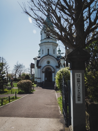
OLYMPUS DIGITAL CAMERA

Location: https://goo.gl/maps/5VvmQot8VvaR9QiP9

Right next to the Catholic church is this circa-19th-century Russian Orthodox church with dramatic night lighting & a bell tower.

5. Go up to Mount Hakodate for Stunning Sunset

OLYMPUS DIGITAL CAMERA

Location: https://goo.gl/maps/zEneqoSvFbsXhApJ9

Place that cannot be missed if you visit Hakodate. The views of the city are stunning. Is recommended to go up an hour or even more in advance before the sunset as it is incredibly crowded and barely are free spaces. You can buy tickets from the cable car station

6. Visit Cape Tachimachi for another stunning Sunset

Location: https://goo.gl/maps/zMuLBvUFqFKmfbti6

Very unpopular place among tourists and well known among locals, a hidden pearl! The place is quite remote but easily accessible by tram. To do this, get off at Jujigai Station in case your tram has no destination Yachigashira Station
Once you arrive at Yachigashira Station, walk about 15 minutes to here as shown in the image below.

Likewise, if hunger calls you, there is a Lawson next to Yachigashira station!

Cape

7. Walk in Goryōkaku Park & Go up to its Tower for 360 Views

Location: https://goo.gl/maps/Xt4qtJqqZ1PhXtph7

100% recommended place to enjoy a beautiful day in the park. The sakura trees here are amazing and cover practically the whole park.
It is also recommended to climb the park tower, as it offers fantastic 360º views of the area

To get here, just take the tram to Goryokaku-Koen-Mae Station and walk to the park. There are indications along the way.
And in case hunger calls again, there is a fantastic restaurant right next to the park called AJISAI. Normally it is always full but the queue is quite fast. Shio Ramen is the typical dish of Hakodate! Must try!

20190505_134706.jpg

Asahikawa

To get to Asahikawa from Sapporo, it is possible by JR train Lilac-Kamui (express train) at about ¥ 4,810. The journey takes about 2 hours and 15 minutes and the views from the train are amazing.
The final destination is Asahikawa Station, right next to it there is an AEON mall that will be your best friend if you are here for a couple of days.

Right in front of the mall is the busiest and most popular street in the area, full of restaurants, shops, cafes … impossible not to find food here!

This city doesn’t offer many things to visit but it’s a great area to visit Furano & Biei! If you do not have a car, the train is your best transportation and Asahikawa is the best place to stay and move around

1. Relax at Tokiwa Park

Location: https://goo.gl/maps/s7kUsLwrmnRZvD1f6

This spacious, serene park with 2 large ponds, swans & cherry blossoms is a popular place to walk.

2. Walk in Asahikawa Forest Park

OLYMPUS DIGITAL CAMERA

Location: https://goo.gl/maps/1PoQyEbRsh4kpccC6

Ideal to spend a morning if you have no more plans to do. The sakura trees are really amazing at this park!

3. Explore Furano & Biei

If something is really worth seeing, it is Furano & Biei and their incredible fields and flowers. Although during the Sakura season the flower fields have not yet blossomed, the views and landscapes are really amazing.
To visit these two places by train, I would recommend visiting Furano first and not missing Tomita Farm. This farm offers beautiful lavender fields that bloom from June.

Furano

Location: https://goo.gl/maps/azbj2VstSSMUX1Va9

To get here, take the train and get off at Lavender-Farm Station or Naka-Furano Station. You can pay directly to the driver or buy tickets at Asahikawa and Furano station.

Biei

Location: https://goo.gl/maps/SmSQGt3J8eAdgFFCA

Once you finish watching Furano, take the train to Biei Station.
In this place there are several places to visit, such as Mild Seven Hills, Zerubu Hills or Hokusei-no-oka Observatory Park. To move around is recommended to rent electric bicycles or motorcycle/car. There is a rental shop right next to the station at this location.
If the night is not coming yet, I would recommend visiting Mild Seven Hills and Zerubu Hills. If you have lack of time as was my case, Mild Seven Hills is the perfect choice.

Along the road on the way to Mild Seven Hills there is a farm where you can taste very popular ice creams!

OLYMPUS DIGITAL CAMERA

Mild Seven Hills offers several points with incredible landscapes. Simply walk or move around and enjoy the nature

OLYMPUS DIGITAL CAMERA

Guangzhou

Guangzhou is a city in the south of the People’s Republic of China, capital of the province of Guangdong.

It has an international airport and communicates with Hong Kong (at a distance of 120 km) by trains, buses and a ferry service.

Easily accessible if you fly to Shenzhen or Hong Kong since it has trains every 15-20 minutes and it takes about 30-40 minutes from Shenzhen and about 1 hour from Hong Kong

What to see in this overcrowded city?

Although almost all cities in China look similar except for large cities, Guangzhou has its peculiarity. Likewise, I would not recommend staying more than 4 days unless you’re visiting the surroundings. A good area to choose hotel is the Kecun area, since it is central and moving around is not very expensive via taxi or didi

1. Canton Tower

OLYMPUS DIGITAL CAMERA

Location: https://goo.gl/maps/YsLkzyGPgbLKUJ6K6

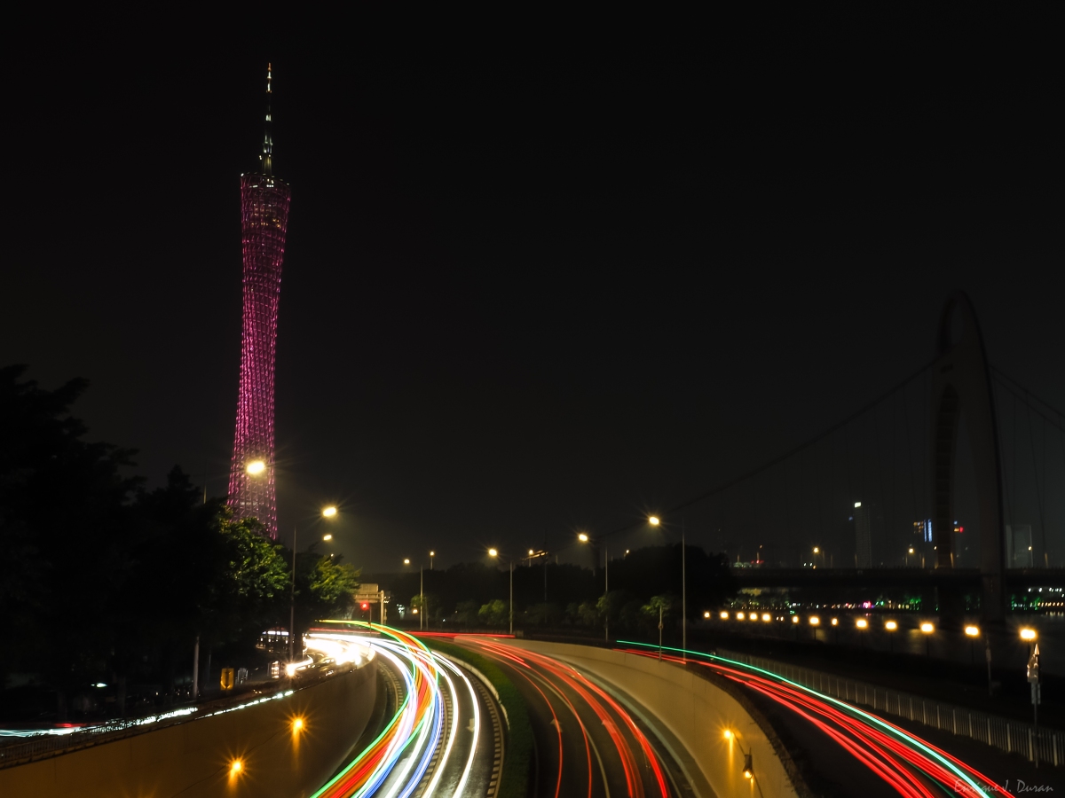
If you have chosen the Kecun area to spend your nights, Canton Tower is just few minutes walking distance away. Recommended to visit during night time since this tower is the emblem of the city

2. Nightlife at Party Pier Plaza

OLYMPUS DIGITAL CAMERA

Location: https://goo.gl/maps/gvgRdF4Ro244foLm7

Both for nightlife and for enjoying its views or for a walk, this area is highly recommended. Great views of the city from the bars entrance area next to the taxi stops

3. Visit the Sacred Heart Cathedral

OLYMPUS DIGITAL CAMERA

Location: https://goo.gl/maps/vvf9A15bwKtBzb7M9

Soaring 1888 Catholic cathedral, one of only a few in the world constructed completely of granite.

Open from 8.30-11.30 and 14.30-1700 on Tue-Fri. 8.30-17.00 on Sat-Sun. Monday closed

4. Visit the Temple of the Six Banyan Trees

Location: https://goo.gl/maps/dKfo15h2yQFxHVPP6

A few minutes walking distance from the cathedral is this temple. Recommended to stop by!

Open Monday to Sunday from 8am to 5pm

Entry fees: 5RMB

5. Visit the Guangxiao Temple

OLYMPUS DIGITAL CAMERA

Location: https://goo.gl/maps/7ifdUPGCkNyi5Bwq7

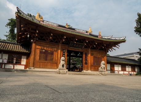
Ancient Buddhist temple complex known for its numerous iron towers, statues, gardens & bodhi tree

Also just a few minutes walking distance from the temple mentioned above is this temple. Perfect for families!

Entry fees: 5RMB

6. Stroll at Xiaozhou Ancient Village 霞洲村

Location: https://goo.gl/maps/cNevxeRTM9umwJwR9

This ancient town is located on the outskirts of the city about 40 minutes by car. Highly recommended to spend half a day and enjoy of its traditional alleys and complexes.

To locate this site once arrived to the area, simply enter the market area or follow the signs. It is also easy to find since the difference between modern and old streets is obvious

7. Explore the Huangpu Village 黄埔村

Location: https://goo.gl/maps/P7QMfHuMq5TuG7kX9

One of the most beautiful traditional villages of Guangzhou. Perfect to spend a day among its alleys. Full of markets, restaurants, temples, shops … and is not very popular yet!

The town is located on the outskirts but easily accessible by car. Taxis in Canton are not relatively expensive and will save us a lot of time that could be used to visit new sites

8. Stroll at TIT Creative Industry Zone

Location: https://goo.gl/maps/BMaCK8GJody53hCC8

Industrial zone transformed into business, coffee shops and art. Perfect place to walk, relax, have breakfast, night photography…

9. Walk by Zhujiang River Promenade

OLYMPUS DIGITAL CAMERA

Location: https://goo.gl/maps/u9a2tGph6NrrrAmC6

Great promenade that goes along the river with views of the city. The end of this promenade leads to the party area

10. Hike up to Baiyunshan

Location: https://goo.gl/maps/ZxkbDgbzNth7suKa9

This mountain has several entrances and routes. The roads are usually through the road, so there is no difficulty at all. Within the area there are food stalls and restaurants. The views from the top are decent but unfortunately the pollution usually covers the views a bit.

Along the way there are several points of interest, such as temples and monuments


Nha Trang

Nha Trang is a coastal city and capital of Khánh Hòa Province, on the South Central Coast of Vietnam. It is bounded on the north by Ninh Hoà district, on the south by Cam Ranh town and on the west by Diên Khánh District.

If you plan to visit this city, it is not necessary to be more than 3 or 4 days unless your purpose of the trip is scuba diving or just enjoy all day at the beach

What to see here?

1. Cathedral of Christ the King

Location: https://goo.gl/maps/XufeEH5ZNX1iJZQ58

Visit this church founded in 1886 by French missionaries. The best way to get there is by taxi. Highly recommended to download Grab app to move around. Taxi costs in Nha Trang is quite affordable.

Entry fees is about 20.000VND. Women can’t wear “too short” clothes

Opened every day from 7.30am to 11.30am & 2pm to 5pm

2. Long Son Pagoda

Location: https://goo.gl/maps/PNAAFpwRpabNCVDv7

Near the cathedral is Long Son Pagoda. From the top there are views of the city but not so spectacular!

Opened Monday to Saturday from 7.30am to 11.30am & 2pm to 5pm.

3. Alexandre Yersin Museum

Location: https://goo.gl/maps/xonYhbBa7mDZjarR6

Museum not very spectacular. For the price of the ticket doesn’t worth at all unless you have no other plans to do

Entry fees: 20.000VND

Opened every day from 7.30am to 11.30am & 2pm to 5pm

4. Ponagar Tower

Location: https://goo.gl/maps/aAsCYvY6yy3Hh59E9

One of the most popular and highly recommended sites. As I mentioned earlier, the best way to get here and by taxi or Grab

Entry fees: 22.000VND

Opened every day from 8am to 6pm

5. Hike up to Ba Ho Waterfalls

OLYMPUS DIGITAL CAMERA

Location: https://goo.gl/maps/273VdEavCCKBu95X7

One of the most recommended activities and the one I really enjoyed. To get here you can hire a driver through your hotel since is a bit remote. Normally hotels have this kind of services. The price varies depending on the hotel. In my case it was 600,000VND per person. The driver waits for you until the time you negotiate with him previously

The hike can last depending on how far you want to go. There are 3 waterfalls in total, and the last one has a medium-high level of risk, since the path of this hike is basically climbing rocks. It is recommended to wear good shoes if you want to reach the third waterfall. Some rocks may be slippery!

Once you get to the waterfalls by taxi, you have to cross a resort and follow the indications. The rocks have signals to follow so be aware for those dangerous paths not suggested to take by the signs

Opened every day from 8am to 4.30pm

6. Snorkel in Nhat Trang Bay

OLYMPUS DIGITAL CAMERA

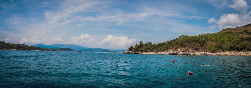
Another recommended activity even if the seabed is not the most optimal in Nha Trang, or at least in tourist areas. You can hire this tour through your hotel
Normally there are 3 islands open for tourists, although depending on the hotel or services you can choose among them

7. Relax at the beach or enjoy the night life

OLYMPUS DIGITAL CAMERA

Relax on the immense beach of the city or simply enjoy the nightlife. The atmosphere is not spectacular but it is worth visiting!

My personal vision of Nha Trang is that it is not very spectacular. For 3 or 4 days it is enough as long as good weather accompanies you. There are more activities on the outskirts of the city, but for this you have to hire taxis or drive and mainly these places are a bit neglected and do not attract too much the attention if you have already visited similar places in Thailand!

Yangshuo

Yangshuo, a county and resort town in southern China’s Guangxi region, is known for its dramatic karst mountain landscape and outdoor recreation. The town is set amid pinnacles like Bilian Feng (Green Lotus Peak), which has a hiking trail to the top. Tour boats offer cruises on the Li River past picturesque countryside from the town of Guilin to the north.

What to see in Yangshuo? Endless activities. These are the ones that I have been able to enjoy so far

Before starting it should be clarified that to get here there are two train stations and can be somewhat confusing:
-Guilin train station
Xingping train station (known as Yangshuo station)
If you arrive at Guilin, you would have to take a bus to Yangshuo and it would take approximately 2 hours.
If you arrive at Xingping, just take a taxi to Yangshuo as it is 30 minutes away. The advantage of getting to Xingping is that once you arrive, you can take advantage of it and go to Li River for a bamboo ride, climb to Laozhaishan peak for an incredible view of the area and visit the old town. If you carrying a lot of stuffs, a taxi to Yangshuo is approximately 80 yuan

1. Li River boat ride

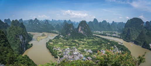
DSC00155

Li River is located in Xingping on the outskirts of Yangshuo.
The boat ride is one of the most popular tourist attractions. To get a ticket it is possible from the ticket window just at the entrance of the river or in an office located in the town near the selected area in the image below. Xingping also offers countless hikes along the river

Mapliriver

2. Hike up to Laozhaishan

DSC00010-Pano

Also located in Xingping, Laozhaishan is located next to the entrance to the river. Just go through the market on the left side facing the river to get there (follow the toilet direction but once you find the crossing, turn left).

The top of the mountain offers stunning views of Xingping
The climb is slightly hard in several sections but its duration is about 35-40 minutes

3. Stroll at Yangshuo town

Visit Yangshuo town is another of the most recommended activities. For shopping, food or just to see its old town transformed into a tourist attraction

4. Nighlife at Yangshuo town

Being increasingly popular, the nightlife in Yangshuo calls the attention in some of its bars. Nothing else to say…

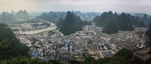
5. Hike up to the TV Tower

DSC00216-Pano

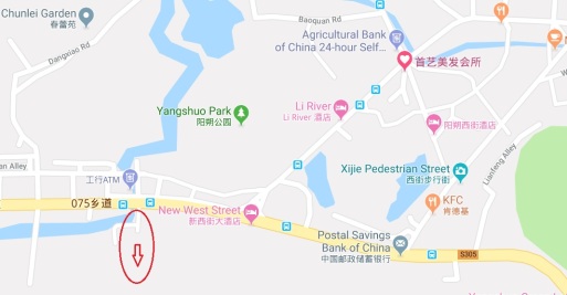
This is not one of the most popular hikes but it is worth its 45 minute climb. This mountain is located just at the entrance of the town about 15 minutes away walking from the old town and offers stunning views of Yangshuo. To get here is a bit confusing since there are no updated maps of this area. The entrance is right in one of the alleys that I mark in the image below (as reference, you could see the TV Tower right in front of the alley up to the mountain peak). Then just follow the streets up. As soon as you enter the alley, turn left and keep going up all the streets, always going up.

mapyangshuo

20190615_194830.jpg

You will have to continue walking up through the streets until you see the entrance to the hike as shows the image below

20190615_180515.jpg

Highly recommended to climb during sunset

6. Hike up to the Moon Hill

DSC00340

This mountain is located on the outskirts of Yangshuo, at the South. To get here you have to take a taxi / didi or rent a motorcycle/bicycle. Didi/Taxi here is quite affordable and let us save a lot of time. The address here in chinese is 月亮山景区 or if using Didi english version, just type Moon Hill
Once arrived, there are two routes: Moon Palace and Dresser
-Direction to Moon Palace reaches up to the hill
-Direction Dresser reaches to a kind of picnic area that personally has better views of the hill than from any other place around, being perfect for photographs

Moon Palace

DSC00276

Dresser

DSC00351

If you visit the Moon Palace area, don’t forget to help the locals by buying them a drink. They hike up here daily to make a living

DSC00306.JPG

There are hundreds of activities to do here. Countless hikes, bike routes, towns to see, … but it takes a lot of time to do them all!

Ma On Shan: a world away

Ma On Shan 馬鞍山 is a saddle-shaped peak in east of Tolo Harbour in the New Territories of Hong Kong. With a height of 702 metres, it stands among the ten highest mountains in Hong Kong. The mountain borders Sha Tin and Tai Po districts.

This hike is one of the most challenging and reach to the peak has a great reward: AMAZING landscapes. But actually, no need to reach to the top of the mountain to really enjoy of these panoramic views. All the trail offers stunning views of the area: Ma On, Sai Kung, Sharp Island,…so all the effort on this hike will be rewarded with different panoramic views, breathtaking panoramic views…

Recommended for this hike a comfortable shoes with good grip, sun block, a lot of water and long pants.

HOW TO GET THERE

To get there take MTR to Ma On Shan Station exit B. The fastest way is to take a taxi from there to the BBQ site. Walk up to the BBQ site from MTR will take more than an hour and is all way up. Save energy for this hike would be essential.

HIKING AROUND

From the BBQ site find the indications to the Family Walk. Below is the route chosen for this hike:mapa

Family Walk > Tiu Shau Ngam > 馬鞍山(馬鞍頭) > MacLehose Trail sec. 4 > Ngong Ping viewpoint > Ma On Shan Country trail > Tai Shui Tseng > Walk to Sai Kung Pier & take a bus back.

The beginning:

A tough section up to the first peaks before the highest. All the hike up has a steep slope and only the last part of the section is sheltered. Narrow trail full of branches and trees. A section with a climbing part & a rope attached to the rocks (easy, no need the rope unless is wet with slippery slope)

Views up to the first little peak. From here can see Ma On Shan town, the Plover Cove Reservoir (right side), Pat Sin Leng Country Park (just in front), Tai Mo  Shan (left side)

PC010250-Pano.jpg

Continuing to the highest peak:

Leaving behind these amazing views, the highest peak is visible after. There is a shortcut and the next peak can be bypassed through a bushy trail on the right side. I didn’t notice of this bypass, just once I saw other hikers taking it instead of climbing up. But worth to climb all the peaks for stunning views like these and the most important reason, we are hikers not tourists

LRM_EXPORT_112695825958818_20181202_100047218.jpeg

The highest peak:

The highest peak is not so tough as the first peaks. The views of Sai Kung on the left side encourage you to the summit.

Views ahead from the top:

PC010314.jpg

The way down is through MacLehose Trail sec. 4. The views along the trail are simply gorgeous.

PC010329-Pano.jpg

LRM_EXPORT_112728606647910_20181202_100120000.jpeg

Reaching to the Ngong Ping viewpoint

PC010368.jpg

From this point to Tai Shui Tseng is all way down and just need to follow the indications.


Shenzhen

Shenzhen is a major city in Guangdong Province, China; it forms part of the Pearl River Delta megalopolis, bordering Hong Kong to the south, Huizhou to the northeast, and Dongguan to the northwest.

So if your a planning a short trip to Shenzhen (no need more than a week unless planning to move around), I’d recommend you visit these particular places:

1. Walk in Shenzhen Bay Park 深圳湾公园

Shenzhen Bay Park 深圳湾公园 is the longest coastal park of Shenzhen (China). If you really love cycling or long walks this place will be perfect with great views of Hong Kong New Territories on the other side of the bay and Nanshan & Futian districts. Ideal for night!

To get there take metro Line 9 at Shenzhen Bay Park station (深圳湾公园站) exit C.

2. Explore Shenzhen Central Park 深圳中心公园

LRM_EXPORT_20180311_164756.jpg

Central Park 深圳中心公园 is located in the heart of the Commercial Business District (CBD) of Futian, Shenzhen (China). It is free entry and considered one of the most underrated parks of the city

To get there take the subway to Huaqiang North Station and Exit A on the orange line and then straight ahead for almost 400 meters

3. Walk & chill at OCT Loft

OCT Loft 华侨城创意园 offers a different side of Shenzhen with its green paths, areas and parks. In additional, OCT Loft is one of the main points of interest for art and photography lovers, yet for coffee lovers as this place offers plenty of cafeshops

To get there take metro Line 1 to Windows of the World 世界之窗 and then transfer to Line 2 to Qiaocheng North Station 侨城北 and take exit B. The easiest way is following the OCT Hospital indications, since is near to the area.

4. Visit the Phoenix Mountain 凤凰山公园

Phoenix Mountain (凤凰山公园)  is located in Bao’an district of Shenzhen (China). This place is a great option for a walk and see a small nature side of Shenzhen with its lake surrounded of mountains and trees. A walk to the top you’ll have views of Bao’an district and a temple with its little pagoda

To get there can take Didi, the bus M433 or metro to 塘尾 Tangwei and walk or grab taxi from here to the mountain

5. Explore Nantou Village 南头

Nantou Ancient Village 南头 is a historical monument in Shenzhen, China. It was the former administrative centre of Xin’an County. This place is perfect if you want to see the traditional side of China within a small neighborhood despite this places has been renewed and became commercial. Stroll through its narrow streets gives you the chance to see how the locals are living here.

To get there take metro to Taoyuan exit B and walk for 10-15 minutes or grab a taxi

6. Drop by Tulip Streets 荷兰花卉小镇

Tulip streets or Netherlands Flower Town 荷兰花卉小镇 is an European-styled town located at Nanshan district in Shenzhen (China) which has been re-opened on 2011.

This little town offers a strange combination of plants, flowers, pets & cafe shops near a park, which makes it a good place to visit if you want to spend few hours of chilling

To get there you can walk for about 10 minutes from Nantou Village or by bus. The bus station is Xinghai Mingcheng (星海名城站), many buses can take you there, such as 42, 201, 223, 324, b623, b688, b699, b702, b813, m364, m370, m375.

The nearest metro station is Daxin Station at Line 1, take exit B and walk for few minutes to the north.

Alternatively, can grab a taxi/didi. By typing in Didi app (English version) “flower”, you may see that the first option is this little town to select

Address: 3008, Yueliangwan Avenue, Nanshan, Shenzhen

地址: 南山区月亮湾大道3008号

7. Walk through Shenzhen Bay Park promenade 

Shenzhen Bay Park Bridge may be an alternative to Shenzhen Bay Park. Both places are connected through the same promenade but the starting point are located in different sides. Through this walk you can see a little port in Sea World, the bridge that connects to Hong Kong and Talent Park. The walk takes roughly more than an hour

To get there take metro to Sea World and walk towards the sea passing by Nanhai Rose Garden, keep walking to Shekou Fishing Harbor and keep coasting to Shenzhen Bay Park Bridge or Talent Park farther ahead. Then you can come back by metro in Wanxia or Haiyue Stations

8. Visit Dafen Painting Village 大芬

Dafen Painting Village 大芬 is a suburb of Buji in Shenzhen, China. The area is an artist village for the production of replicas of masterworks and outsourcing of original art creation. Great place for a stroll and enjoy the traditional art of China

To get there take metro to Dafen Station exit A1 and walk straight away until finding the neighborhood

9. Hike up to Nanshan Mountain

Nanshan mountain also known as Nanshan Park, is one of the most popular mountains in Shenzhen. Great place for an amazing cityscape of Shenzhen. From the top of the mountain you will see mostly all Shenzhen. Highly recommended to visit or stay at night. The “hike” is paved with stairs and lights so is basically a walk to the top and safe to visit or back at night

To get there take metro yo Sea World exit D and head towards the mountain and then follow the indications to Nanshan Park.

10. Day/Night Hike to TanglangShan 塘朗山 郊野公园

Tanglang Mountain 塘朗山 郊野公园 is located in Nanshan District, Shenzhen (China). With an elevation of 430m, Tanglang Mountain is the third highest peak in Shenzhen.

This mountain has two routes to reach the summit: road and paved stones trail. The climbing takes about 1-2 hours in relax rate or 45 minutes in good rate.

The hike is pretty easy and safe what makes it is perfect for a night hike by following the road. The night views from the top are pretty amazing

To get there take metro to Taoyuancun Line 7 and Exit D. Walk forward until seeing the mountain in the right side. Then walk towards the mountain and will be visible the Trail starting point

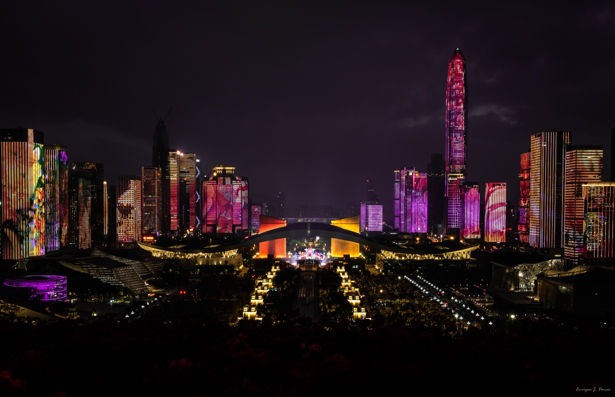
11. Watch the Lights Night Show at Lianhuashan Park 莲花山公园

P2020300.jpg

Lianhuashan Park 莲花山公园 is a hill and urban park in Shenzhen, China. It is located at the northern end of the Futian Central Business District and covers an area of 150 hectares. Atop the 106-metre hill is a large bronze statue of Deng Xiaoping and views of Futian Central Business District. This park is very popular for its night lights shows, so is highly recommended to come before night and find a spot at the top to have a look to the night show. It usually starts at 8pm and last about one hour

To get there take metro to Children’s Palace exit F2, cross the park until finding the stairs up to the top

12. Hike at Yangtaishan 羊台山

Located in Bao’an district of Shenzhen (China), Yangtaishan 羊台山 is a mountain of about 587 meters in height. It’s not as high as Wutong mountain but the summit will surprise you with its stunning views of Bao’an, Nanshan & Longgang districts.

To get there take the bus 769 or 635. If you take the bus 635, you may transfer bus at Shiyan Bus General Station and grab the bus 769 to Yangtai Mountain Station.

Otherwise, you may take Didi or taxi to get there. We grabbed a taxi from Shenzhen North Station to Shiyan entrance and costs 45RMB

13. Escape to Dapeng Old Town 

is a well-preserved town located at the east of Longgang District in Shenzhen (China). Through its narrow streets can get to the Fortress and at 5-10 minutes driving distance can get easily to Dongshan temple. By walking distance should be about 30-40 minutes though

To get there:

CAR

This is the way how I got there since is the easiest and recommended way. The journey takes about one hour departing from Louhu/Longgang district. Find a friend with car or rent it totally worth it.

BUS

This is the slowest and the last alternative. Usually takes about 2 hours or more

-From Yinghu Bus Station: Bus E11 to Dapeng -> Bus B756 to Dapeng Suocheng

-From Futian Bus Station: Bus H92 to Dapeng -> Bus B756 to Dapeng Suocheng

-From Longgang: Bus 833 to Dapeng -> Bus B756 to Dapeng Suocheng

-From Longgang Bus Terminal: Bus 818 to Dapeng -> Bus B756 to Dapeng Suocheng


Macau

Macau was formerly a colony of the Portuguese Empire, after Ming China leased the territory as a trading post in 1557. Macau is the gambling capital of the world. Its economy is heavily dependent on gambling and tourism, with the largest gambling revenue since 2006

Since Macau is the gambling capital of the world, the whole place is full of Casinos & Hotels which provide FREE shuttle buses to different destinations. So if you are not in the rush, this transportation system may make you save a lot of money

1. The Venetian

PB050201.jpg

One of the most popular hotels & casinos, people visit this place especially for The Grand Canal Shoppes

To go there, take The Venetian Shuttle Bus from the Ferry Terminal directly

2. Taipa Village

Taipa Village is a well-preserved non-gaming destination which offers a perfect alternative to the city’s casino resorts. Perfect for dining & souvenirs shopping.

DSC00913

Through its streets you can easily find a lot of Portuguese restaurants with a really great food quality. Try there bacalhau à brás is a must!

To go there you can walk from The Venetian. The journey takes about 20 minutes and there are indications along the way

3. Taipa Houses-Museum

At the East of Taipa Village is located these colonial houses. Along the path to the south is located Our Lady of Carmel church & the Wetland

4. Senado

PB050221.jpg

Senado Square is a paved town square in Sé and part of the UNESCO Historic Centre of Macau World Heritage Site. Worth to have a look since it is on the way to the Ruins of St. Paul

To go there walk from Taipa Village to City of Dreams and take a shuttle bus to Grand Emperor Hotel & walk

5. Ruins of St. Paul

DSC00969

The Ruins of St. Paul are the ruins of a 17th-century complex in Santo António. This place is a must too see but is often packed with thousand of tourists. However, worth to have a look

To go there walk from Senado to the Ruins. The journey takes about 10 minutes and there are a lot of shops along the way

6. Monte Fort

On the right side of the ruins is located the Fort. The top of the fort offers great views of the north of Macau