Ma On Shan: a world away

Ma On Shan 馬鞍山 is a saddle-shaped peak in east of Tolo Harbour in the New Territories of Hong Kong. With a height of 702 metres, it stands among the ten highest mountains in Hong Kong. The mountain borders Sha Tin and Tai Po districts.

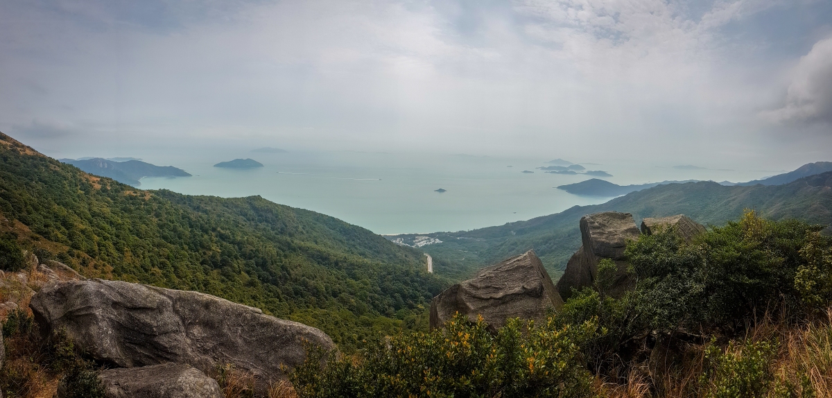
This hike is one of the most challenging and reach to the peak has a great reward: AMAZING landscapes. But actually, no need to reach to the top of the mountain to really enjoy of these panoramic views. All the trail offers stunning views of the area: Ma On, Sai Kung, Sharp Island,…so all the effort on this hike will be rewarded with different panoramic views, breathtaking panoramic views…

Recommended for this hike a comfortable shoes with good grip, sun block, a lot of water and long pants.

HOW TO GET THERE

To get there take MTR to Ma On Shan Station exit B. The fastest way is to take a taxi from there to the BBQ site. Walk up to the BBQ site from MTR will take more than an hour and is all way up. Save energy for this hike would be essential.

HIKING AROUND

From the BBQ site find the indications to the Family Walk. Below is the route chosen for this hike:mapa

Family Walk > Tiu Shau Ngam > 馬鞍山(馬鞍頭) > MacLehose Trail sec. 4 > Ngong Ping viewpoint > Ma On Shan Country trail > Tai Shui Tseng > Walk to Sai Kung Pier & take a bus back.

The beginning:

A tough section up to the first peaks before the highest. All the hike up has a steep slope and only the last part of the section is sheltered. Narrow trail full of branches and trees. A section with a climbing part & a rope attached to the rocks (easy, no need the rope unless is wet with slippery slope)

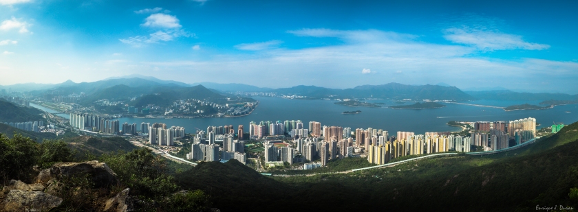
Views up to the first little peak. From here can see Ma On Shan town, the Plover Cove Reservoir (right side), Pat Sin Leng Country Park (just in front), Tai Mo  Shan (left side)

PC010250-Pano.jpg

Continuing to the highest peak:

Leaving behind these amazing views, the highest peak is visible after. There is a shortcut and the next peak can be bypassed through a bushy trail on the right side. I didn’t notice of this bypass, just once I saw other hikers taking it instead of climbing up. But worth to climb all the peaks for stunning views like these and the most important reason, we are hikers not tourists

LRM_EXPORT_112695825958818_20181202_100047218.jpeg

The highest peak:

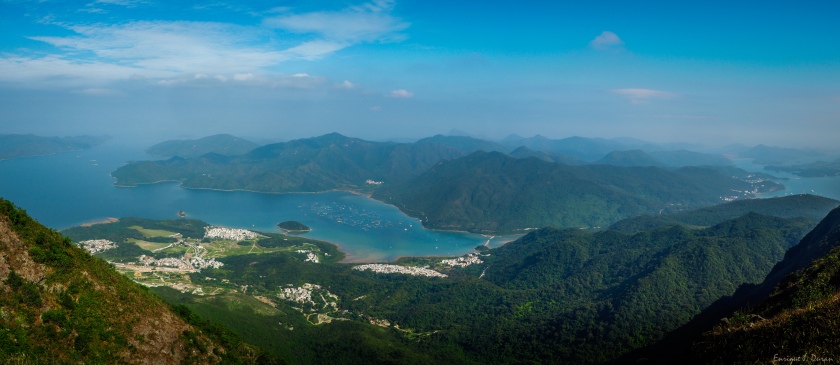
The highest peak is not so tough as the first peaks. The views of Sai Kung on the left side encourage you to the summit.

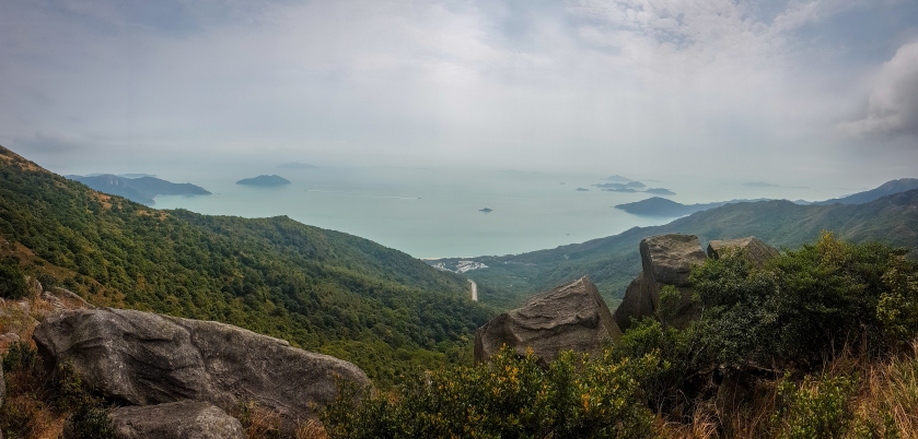
Views ahead from the top:

PC010314.jpg

The way down is through MacLehose Trail sec. 4. The views along the trail are simply gorgeous.

PC010329-Pano.jpg

LRM_EXPORT_112728606647910_20181202_100120000.jpeg

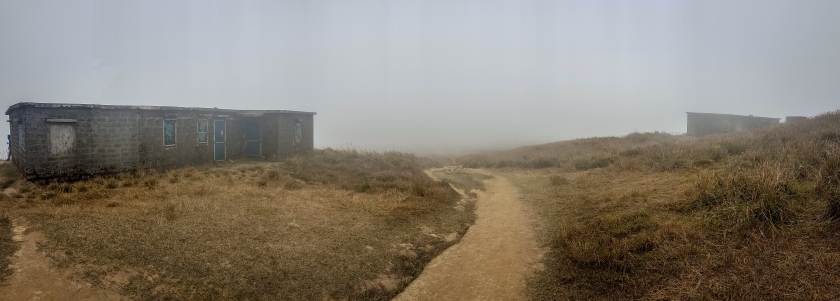
Reaching to the Ngong Ping viewpoint

PC010368.jpg

From this point to Tai Shui Tseng is all way down and just need to follow the indications.


Sunset Peak: Amidst the Mist

ENGLISH & ESPAÑOL

Sunset Peak (Tai Tung Shan 大東山) is the third highest peak in Hong Kong located in Lantau Island and stands at a height of 869 metres (2,851 ft) above the sea level. The second highest peak is Lantau Peak located right in front of this peak with Pak Kung Au in between.

My route started at Pak Kung Au through Section 2 and ended at Nam Shan near the Campsite. The total distance is 7km and about 4 hours. The trail is kind similar to Lantau Peak but perhaps due to the fog I really couldn’t to enjoy as much as I did in Lantau Peak despite it was also partially cloudy.

1

HOW TO GET THERE

To get there you should take MTR to Tung Chung station exit B and grab the bus 3M. The bus station is passing by the cable car station. You have to get off at Pak Kung Au after 15-20 minutes of bus ride. You will notice of the stop easily, since many people will get off right there. Continue walking further ahead and you will see Sunset Peak indications to start the trail.

HIKING AROUND

The starting is the most difficult part of this trail since everything are steps and rocks for almost 40-50 minutes but with stunning views behind of Lantau Peak. You may see during the climbing the Lantau Peak trail and its mountains.

Almost arriving to the top of this first climb the views of Soko Islands are really great.

OLYMPUS DIGITAL CAMERA

By looking at opposite direction of Soko Islands is easy to see Tung Chung and HK Airport. Much better with clearer weather

Continuing walking the views will be clearer of Soko Islands, the Trail behind and Shek Kwu Chao. The views are stunning!

LRM_EXPORT_20180220_221816

The views heading to Yi Tung Shan are also amazing despite it was foggy during my day

Passing by the campsite there are a lot of allegedly abandoned shelters.

LRM_EXPORT_20180221_123727

Once crossed the Campsite, the descent will starts with views of Pui O and Chi Ma Wan Peninsula. Personally, the descent was rather tougher than ascent maybe due to the weather conditions.

The latest photo is a crossing to choose or continue to Nam Shan or turn to Tung Chung. According with the map, the trail back towards Tung Chung takes about 1 hour or so.

Finishing the Trail, once you see the road on the right side, simply get to the road, then turn left and go up to the bus stop. From there can grab the bus 3M to Tung Chung Station in about 20 minutes

DETAILS

  • Location: Sunset Peak @ Lantau Island, Hong Kong
  • Transportation: MRT to Tung Chung & bus 3M to Pak Kung Au // Return: bus 3M
  • Time spent: 4 hours
  • Weather conditions: unpredictable! Cloudy, foggy, cold, windy…
  • Season: End of February
  • Score: 8.5/10