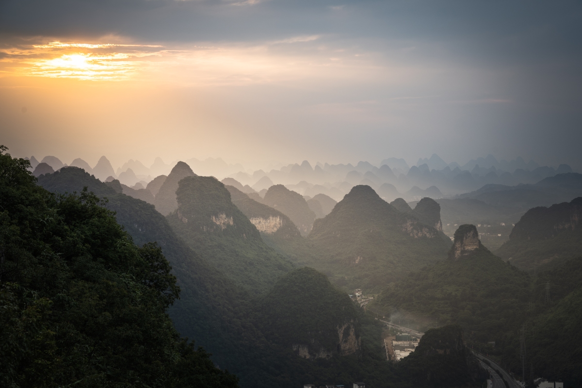
Yangshuo, a county and resort town in southern China’s Guangxi region, is known for its dramatic karst mountain landscape and outdoor recreation. The town is set amid pinnacles like Bilian Feng (Green Lotus Peak), which has a hiking trail to the top. Tour boats offer cruises on the Li River past picturesque countryside from the town of Guilin to the north.
What to see in Yangshuo? Endless activities. These are the ones that I have been able to enjoy so far
Before starting it should be clarified that to get here there are two train stations and can be somewhat confusing:
-Guilin train station
–Xingping train station (known as Yangshuo station)
If you arrive at Guilin, you would have to take a bus to Yangshuo and it would take approximately 2 hours.
If you arrive at Xingping, just take a taxi to Yangshuo as it is 30 minutes away. The advantage of getting to Xingping is that once you arrive, you can take advantage of it and go to Li River for a bamboo ride, climb to Laozhaishan peak for an incredible view of the area and visit the old town. If you carrying a lot of stuffs, a taxi to Yangshuo is approximately 80 yuan
1. Li River boat ride

Li River is located in Xingping on the outskirts of Yangshuo.
The boat ride is one of the most popular tourist attractions. To get a ticket it is possible from the ticket window just at the entrance of the river or in an office located in the town near the selected area in the image below. Xingping also offers countless hikes along the river

2. Hike up to Laozhaishan

Also located in Xingping, Laozhaishan is located next to the entrance to the river. Just go through the market on the left side facing the river to get there (follow the toilet direction but once you find the crossing, turn left).
The top of the mountain offers stunning views of Xingping
The climb is slightly hard in several sections but its duration is about 35-40 minutes
3. Stroll at Yangshuo town


Visit Yangshuo town is another of the most recommended activities. For shopping, food or just to see its old town transformed into a tourist attraction
4. Nighlife at Yangshuo town


Being increasingly popular, the nightlife in Yangshuo calls the attention in some of its bars. Nothing else to say…
5. Hike up to the TV Tower

This is not one of the most popular hikes but it is worth its 45 minute climb. This mountain is located just at the entrance of the town about 15 minutes away walking from the old town and offers stunning views of Yangshuo. To get here is a bit confusing since there are no updated maps of this area. The entrance is right in one of the alleys that I mark in the image below (as reference, you could see the TV Tower right in front of the alley up to the mountain peak). Then just follow the streets up. As soon as you enter the alley, turn left and keep going up all the streets, always going up.


You will have to continue walking up through the streets until you see the entrance to the hike as shows the image below

Highly recommended to climb during sunset


6. Hike up to the Moon Hill

This mountain is located on the outskirts of Yangshuo, at the South. To get here you have to take a taxi / didi or rent a motorcycle/bicycle. Didi/Taxi here is quite affordable and let us save a lot of time. The address here in chinese is 月亮山景区 or if using Didi english version, just type Moon Hill
Once arrived, there are two routes: Moon Palace and Dresser
-Direction to Moon Palace reaches up to the hill
-Direction Dresser reaches to a kind of picnic area that personally has better views of the hill than from any other place around, being perfect for photographs
Moon Palace

Dresser

If you visit the Moon Palace area, don’t forget to help the locals by buying them a drink. They hike up here daily to make a living

There are hundreds of activities to do here. Countless hikes, bike routes, towns to see, … but it takes a lot of time to do them all!